• Skip to primary navigation
  • Skip to main content
  • Skip to primary sidebar
  • Skip to footer
Jennifer Marohasy

Jennifer Marohasy

a forum for the discussion of issues concerning the natural environment

  • Home
  • About
  • Publications
  • Speaker
  • Blog
  • Temperatures
  • Coral Reefs
  • Contact
  • Subscribe

cyclone

At Last, A Cyclone

January 1, 2022 By jennifer

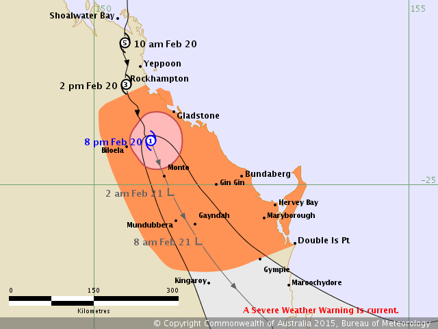
The Bureau has called the low-pressure system off the northeast of Australia as a category two cyclone.   Local weather reports are warning:

“Large and powerful surf conditions in the afternoon and evening are expected to be hazardous for coastal activities such as rock fishing, swimming and surfing.

With fair-sized waves rolling in from the north facing points, the local surfers were out early this morning, so the carpark at the main entrance to Noosa National Park was a traffic jam.    I was keen to see my cliff face* (below Boiling Pot Lookout) on the high tide with the big swells, but alas the traffic prevented it.  I should have walked!

This low-pressure system has intensified on a New Moon (1st January) at Perigee (2nd January).   These are conditions often associated with cyclones.

This cyclone, named Seth, is tracking south, as I would expect given the Moon will be heading south until midnight on Sunday, when it will reach maximum declination just to the north of Noosa and then turn.  I watch, and download data, on the Moon’s changing orbit from the NASA Jet Propulsion Lab.

According to the latest report from the Bureau, Seth was producing wind gusts of up to 110 kilometres per hour and was not expected to cross the coast.

Thanks to the Bureau for this track map.

We are so overdue for cyclones crossing the coast.   Last summer, the 2020–21 Australian region cyclone season was another ‘below average’ season, producing a total of just 8 tropical cyclones with just 3 of these categorised as severe. So, since official records began in 1970 it is a case of less cyclones and less severe cyclones.

Of course, all of this contradicts the official ‘climate action now’ narrative that falsely claims an increase in the incidence of cyclones in accordance with the illusionary climate change catastrophe reported nightly on the news by all the ‘useful idiot’ journalists. (Don’t be one of the useful idiots, join the resistance by subscribing to my regular e-newsletter.)

I’m going to be out tomorrow morning (Sunday morning) to try and record the second highest tide at the cliff face, and, also on Monday morning for the highest tide.   I’m hoping to put up my drone, but if it’s too gusty Skido will refuse to take-off.  It would be so good to have a professional with a long lens across the other side of Tea Tree Bay looking back to the cliff face, to catch the highest tide with the big swell.   You don’t have to get on the platform, there will be lots of opportunities looking back from the main track.

**** More information on how to get to my cliff face is at my sea level change page, click here.

The image below was taken on the highest tide two years ago looking back to the rock platform below Boiling Pot Lookout in Noosa National Park.  Can you see me within the red circle to the bottom left?  There was a low pressure system off shore that year.  It will be more intense this year so the tide should be even higher, but will it reach the bottom of the cliff face?  Will I be washed away?

Filed Under: Information Tagged With: cyclone, lunar cycles

When Measurements Don’t Matter: Calem Smith

February 24, 2015 By jennifer

When measurements don’t matter…   a YouTube by Calem Smith explaining how the Bureau of Meteorology grossly misrepresented the strength of Tropical Cyclone Marcia.

Filed Under: Information Tagged With: cyclone

Missing Observational Data for Middle Percy Island

February 24, 2015 By jennifer

IT is valid for the Australian Bureau of Meteorology to estimate the intensity of a cyclone using computer models when it is far out to sea.  But once that same cyclone passes over a weather recording station the modelling data must be updated with real world observational data.

In the case of Marcia even after this cyclone passed over Middle Percy Island recording a  minimum central pressure of only 972 hPa, maximum wind gust of 208 km/h and maximum wind speed of 156 km/h, the Bureau continued to report only on the basis of output from a computer model.  The cyclone was clearly a category 3 system, yet the Bureau called it as a 5.

The Bureau has since removed the observational data that was once available on their website, I printed it off at the time and had it digitized this morning.  That information is here:

Middle Percy Obs Now Removed

It would be travesty if Marcia was recorded as a category 5 cyclone at landfall based on output from a dysfunctional computer model, rather than as a category 3 as clearly indicated by the observational data.

Filed Under: Information Tagged With: cyclone

How do we know that Cyclone Marcia was a Category 5 at landfall?

February 20, 2015 By jennifer

Track map BOMTHE Australian Bureau of Meteorology issued a media release last night (19thFebruary) with the headline “Tropical Cyclone Marcia to reach Category 5 system at landfall”.    This morning there was extensive media reporting of Marcia having reached landfall as a Category 5.

But where is the evidence?  And who is asking for it?  Like the Bureau, the Australian media seem intent on hyping the event, rather than providing any critical or dispassionate assessment.

The first technical bulletin for Marcia, issued at 4pm today states that, “surface observations have not captured the highest winds,” and acknowledges that the minimum pressure so far recorded has been 975 hPa inside the eye wall at 1.30 pm at Rockhampton.

In fact, this central pressure only qualifies Marcia as a Category 2.  As one would expect of a category 2, both Rockhampton and Yeppoon have sustained relatively minor house damage and significant damage to trees.

Just before the cyclone made landfall it passed over Middle Percy Island, to the north of Rockhampton, and the lowest central pressure recorded for the system then was 971.6 hPa at 3.39 am this morning.   A wind gust of 208 km/hr was recorded at 4.30 am, which suggests Marcia was almost a Category 3 at this time, even though its central pressure was never recorded as below 970 hPa.   The central pressure of a cyclone needs to be somewhere in the 970 to 955 hPa range to be a Category 3.

This would suggest that even as Marcia approached the Queensland coastline it was never more than a Category 2.

Indeed the raw observational data available at the Bureau’s website would suggest that Cyclone Marcia made landfall just south of Middle Percy Island as a Category 2 approaching a Category 3, but had already weakened to a very ordinary Category 2 approaching Category 1 by the time it reached the city of Rockhampton.

This evidence, however, contradicts the track map at the Bureau’s website, and also the extensive media suggesting that Cyclone Marcia made landfall as a Category 5, and was still a Category 3 system when it reached Rockhampton.

The Australian Bureau of Meteorology has been hyping the possibility of a devastating cyclone hitting the Queensland coastline all year.  It forecast that Marcia would hit as a Category 5 cyclone, but where is the evidence?

*******

Thanks to everyone who has emailed me today with best wishes, assuming I was in Yeppoon when Marcia hit.   Our house there is still standing, with some trees down in the front yard.  I was in Brisbane last night, and am now in Noosa.

Filed Under: Information, News Tagged With: cyclone

Primary Sidebar

Recent Comments

  • Ian Thomson on Vax-ed as Sick as Unvax-ed, Amongst My Friends
  • Dave Ross on Vax-ed as Sick as Unvax-ed, Amongst My Friends
  • Dave Ross on Vax-ed as Sick as Unvax-ed, Amongst My Friends
  • Alex on Incarceration Nation: Frightened of Ivermectin, and Dihydrogen monoxide
  • Wilhelm Grimm III on Incarceration Nation: Frightened of Ivermectin, and Dihydrogen monoxide

Subscribe For News Updates

  • This field is for validation purposes and should be left unchanged.

November 2025
M T W T F S S
 12
3456789
10111213141516
17181920212223
24252627282930
« Jan    

Archives

Footer

About Me

Jennifer Marohasy Jennifer Marohasy BSc PhD has worked in industry and government. She is currently researching a novel technique for long-range weather forecasting funded by the B. Macfie Family Foundation. Read more

Subscribe For News Updates

Subscribe Me

Contact Me

To get in touch with Jennifer call 0418873222 or international call +61418873222.

Email: jennifermarohasy at gmail.com

Connect With Me

  • Facebook
  • LinkedIn
  • RSS
  • Twitter
  • YouTube

Copyright © 2014 - 2018 Jennifer Marohasy. All rights reserved. | Legal

Website by 46digital