
If the weather is fine, come stand on the rock platform with me, below the Boiling Pot Lookout, in Noosa National Park, on the highest tide for the year! If the weather is fine, it may help calm you, if you are anxious about climate change because chances are we won’t even be washed away.
Last year, we were there at 8.51 am on Sunday 28th February for the highest tide forecast at 2.23 metres. The waves didn’t even reach to our ankles.
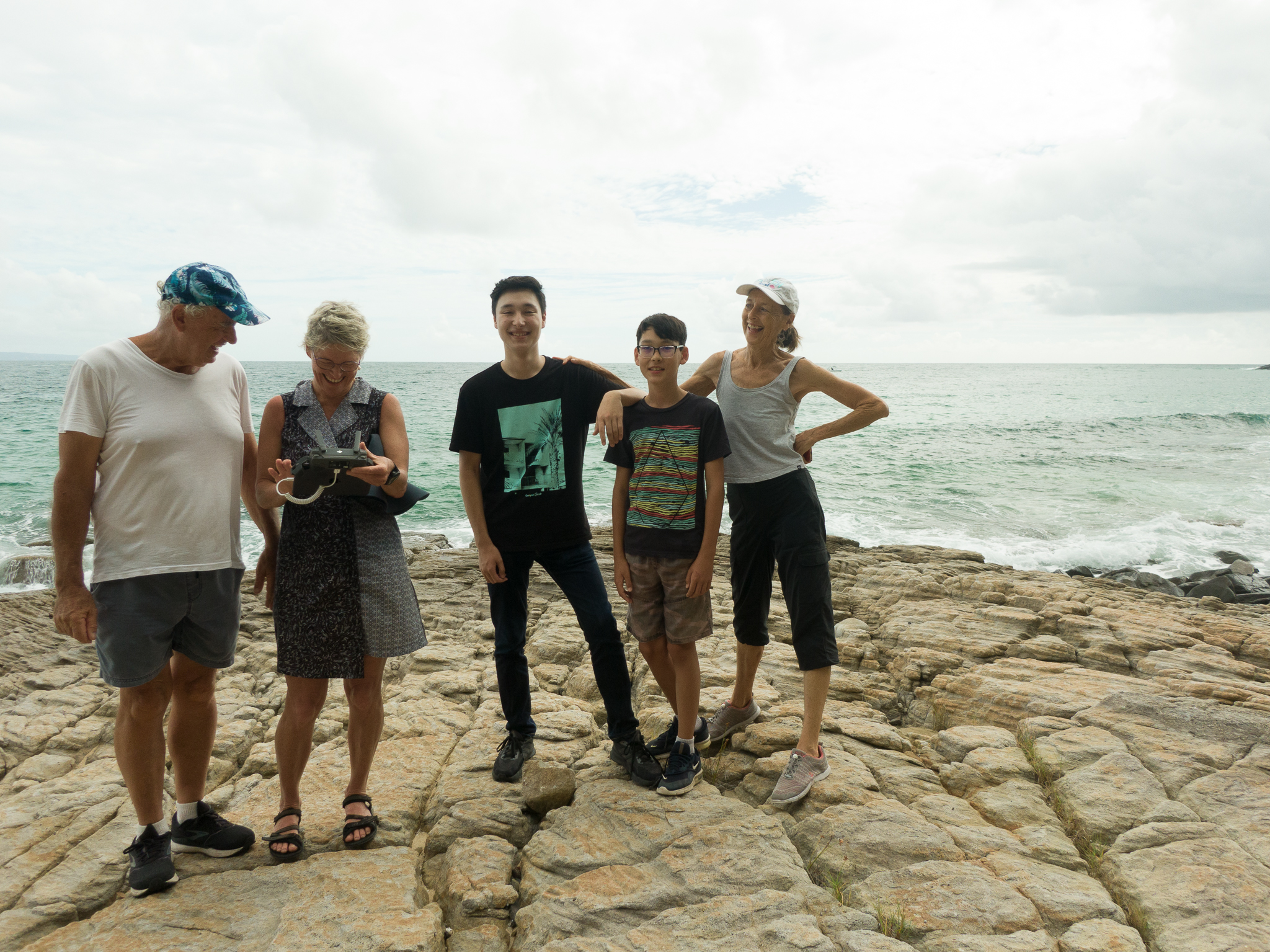
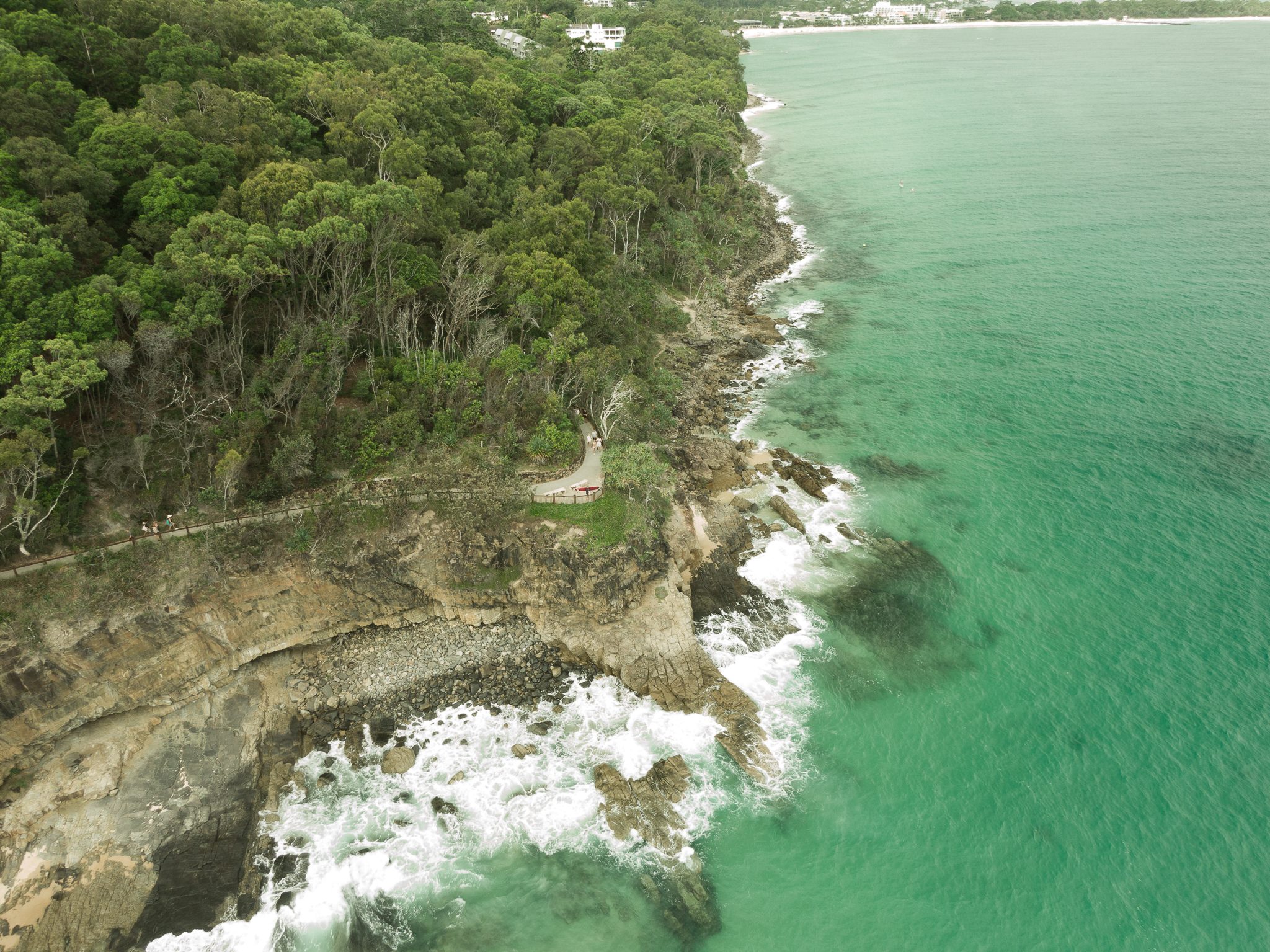
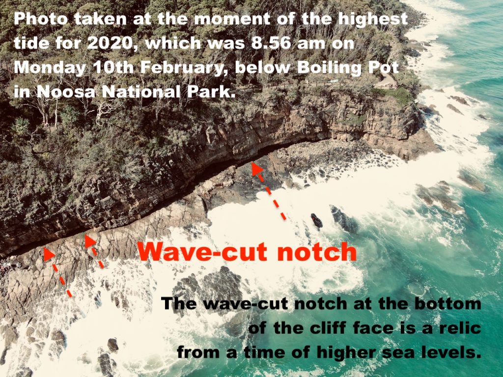
Two years ago, on Monday 10th February 2020, there was a fair swell, with the low pressure system off-shore, but a few of us never-the-less were on that rock ledge (the wave-cut platform below Boiling Pot) for the highest tide for that year.
WHAT ARE MARINE POTHOLES?
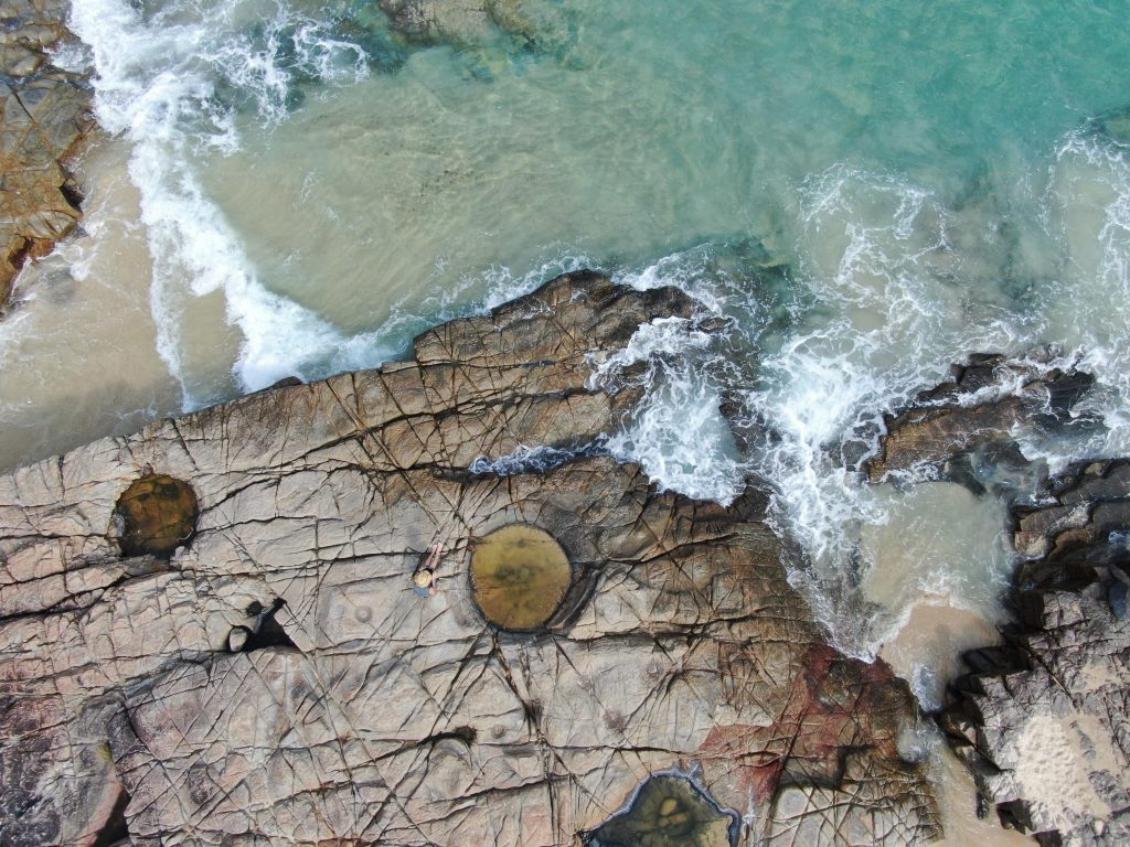
Marine potholes are formed by the relentless grinding of boulders – of a harder material perhaps granite – into softer sandstone, after being caught in a depression.
Pounding surf will cause the harder rock to swirl round and round, eroding away and creating a circulation marine pothole.
The grinding, that created these potholes, could only have happened when sea levels were higher: when this platform was underwater.
Marine potholes like this can be found along seashores around the world, with a particular width to depth ratio.
It is a fact, that while some are concerned with sea level rise of about 36 cm over the last 100 years, the more significant trend is sea level fall of some 1.5 to 2 metres since the Holocene High Stand some 7,500 years ago. The presence of these potholes in platforms above the high tide mark is evidence of sea level fall but from how long ago?
HOW ARE PLATFORMS FORMED?
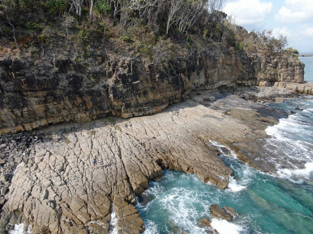
Wave cut platforms form just below sea level, in the intertidal zone, where the cutting action of waves will bring down great lumps of rock from above.
The debris will be removed by the wash, beyond the intertidal zone.
The headland will recede landward, as the sea eats into the cliff-face.
And so, cliffs are formed, with wave-cut platforms at their base.
As the cliff retreats landward, the platform will become wider.
Observation is the most basic form of science, it can also be so cathartic – watching how high the highest waves reach on the highest tide along the seashore.
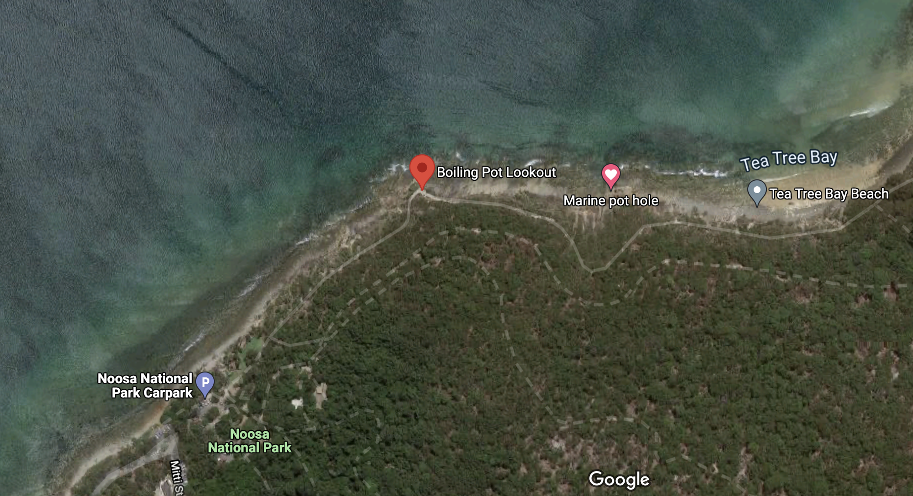
The potholes are best accessed by walking to Tea Tree Bay first via the coastal track, and then heading north west along the shoreline.
Rock fishing is one of the most dangerous sports in Australia with 158 deaths in the 13 years to 2017. To reduce the risk of injury Surf Life Saving Australia urges all rock fishers to:
• Wear a lifejacket
• Check tides weather and surf conditions
• Take personal responsibility, think twice and assess your safety
• Plan an escape route in case you are washed into the water
• Wear the right gear i.e. lifejacket, appropriate footwear, lightweight clothing
• Never fish alone, and make sure you tell someone where you are going and when you will be back
• Look for Angel Rings or someone other floatation device to throw to someone in trouble
• Call 000 if assistance is required.
 Jennifer Marohasy BSc PhD has worked in industry and government. She is currently researching a novel technique for long-range weather forecasting funded by the B. Macfie Family Foundation.